Parking Management Systems May Be Heading Toward 3D
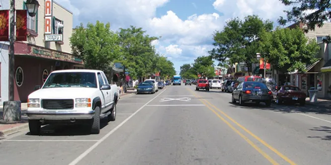
Cities worldwide are experimenting with smarter ways to manage parking. Some utilize parking occupancy data to dynamically adjust pricing, thereby ensuring adequate space availability; others deploy roadside parking systems equipped with ground sensors, integrating them into broader smart city platforms; still others employ networked sensors to monitor thousands of individual parking spaces. These initiatives share a clear objective: to reduce vehicular congestion, enhance the efficiency of roadside parking, and make more effective use of limited urban space.
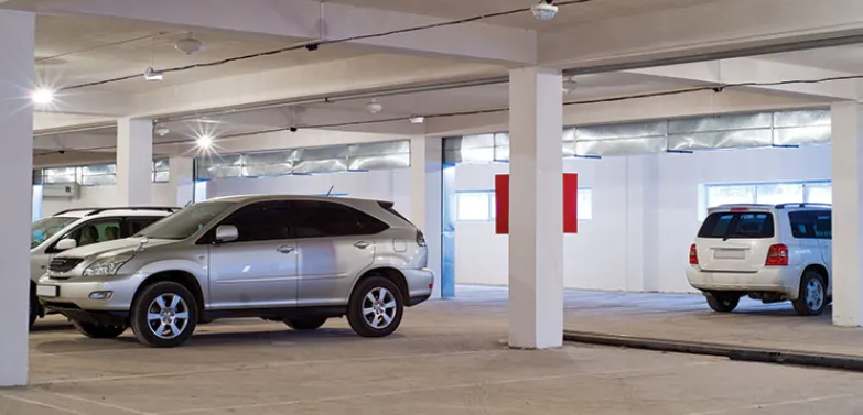
Although these parking management systems have been implemented in numerous countries globally, many still rely on fragmented or incomplete data. The installation and large-scale maintenance of ground sensors/loop detector are costly, while camera-based surveillance systems can be susceptible to lighting conditions or raise privacy concerns. As cities seek to scale up their smart parking initiatives, the challenge lies not merely in collecting data, but in doing so reliably, efficiently, and at scale.
LiDAR technology is beginning to gain significant traction within the parking management system sector. LiDAR—an acronym for Light Detection and Ranging—employs laser pulses to precisely capture three-dimensional information about the physical environment, thereby providing a robust data foundation for modern parking management. From monitoring parking space occupancy to classifying vehicle types, LiDAR-based systems empower operators to gain insights into parking dynamics with a level of granularity that traditional solutions struggle to match.
Why LiDAR Is Well-Suited for Smart Parking Management Systems?
At its core, LiDAR operates by using laser pulses to measure distances. These measurements generate a dense, three-dimensional representation of the environment—known as a "point cloud." Unlike camera imagery, this data remains unaffected by ambient lighting conditions; instead, it describes the geometry of the surrounding environment with high precision.
This 3D data offers numerous advantages for parking applications.
First, LiDAR maintains consistent performance across constantly changing environmental conditions. Factors that typically compromise camera systems—such as darkness, glare, or shadows—have minimal impact on laser-based measurements. This makes LiDAR particularly well-suited for outdoor parking lots, garages, and roadside environments where lighting conditions fluctuate throughout the day.
Second, LiDAR captures physical structures rather than visual appearances. Vehicles, curbs, obstacles, and pedestrians are all detected as three-dimensional objects. This enables algorithms to reliably identify and track objects without first having to analyze two-dimensional images that are prone to misinterpretation.
Finally, LiDAR data supports privacy-conscious surveillance. Since this technology measures distance rather than visual details, it does not capture identifiable features—such as human faces or license plates—unless supplemented by additional sensors. For municipalities and operators facing strict data protection requirements, this can be a significant advantage. Collectively, these characteristics make LiDAR a powerful foundation for data-driven parking systems.
Occupancy Monitoring: LiDAR in Practical Parking Management System Applications.
One of the most direct applications of LiDAR in parking environments is the monitoring of vehicle occupancy.
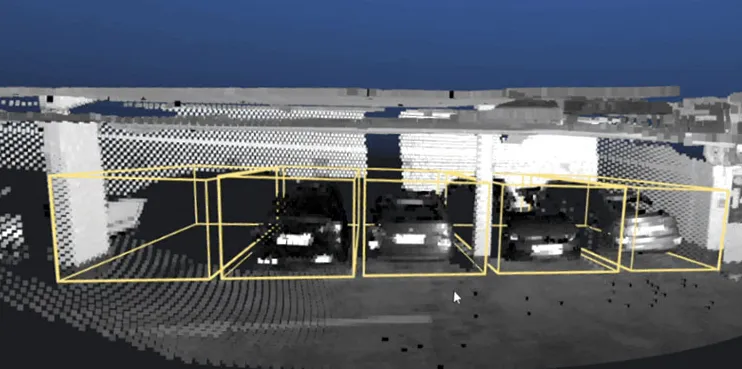
In a typical installation scenario, LiDAR sensors are mounted on existing infrastructure—such as light poles or building facades—overlooking a parking lot or street area. The sensors continuously scan their surroundings, generating a stream of 3D data points. Software processes this data in real time to detect objects, determine their precise locations, and classify them.
Parking spaces can be designated within the system. When a vehicle enters the monitored zone, the sensors detect it within the point cloud by identifying an object that was not previously present. The detected points trigger a change in the parking space's occupancy status. When the vehicle departs, the space is subsequently marked as available again.
Due to the extremely high precision of LiDAR data, size thresholds can be established for objects detected within each monitoring zone. This ensures that small objects—such as shopping carts, debris, or passing pedestrians—do not trigger false occupancy events. A parking space is marked as occupied only when the detected object exceeds preset parameters (e.g., the typical dimensions of a vehicle). This configurable filtering mechanism enhances detection accuracy, ensuring reliable occupancy data even in complex environments characterized by frequent vehicle movement.
Because LiDAR is capable of capturing comprehensive spatial information, a single sensor can often monitor multiple parking spaces simultaneously. In structured environments—such as parking lots or curbside areas with clearly defined boundaries—a single installation can effectively cover an entire zone.
While knowing whether a parking space is occupied is useful, understanding “what“ is occupying it can be even more valuable.
LiDAR-based parking management systems can classify vehicles based on their size and shape. By analyzing the 3D geometry captured within the point cloud, algorithms can distinguish between categories such as passenger cars, vans, trucks, or two-wheeled vehicles.
This information opens the door to a wide range of practical applications. For instance, operators can analyze whether curbside parking spaces—originally designated for short-term passenger drop-offs—are frequently being occupied by delivery vans. Similarly, data regarding large vehicles can assist cities in assessing parking demand within loading zones or commercial parking lots.
Vehicle classification also facilitates more effective enforcement. If regulations restrict certain types of vehicles from utilizing specific spaces, automated monitoring systems can flag potential violations for review.
Within parking facilities, vehicle classification data helps operators understand how vehicles of varying sizes impact capacity and traffic flow efficiency. As urban vehicle fleets become increasingly diverse—ranging from compact electric vehicles to large delivery trucks—this information is becoming ever more critical for facility planning.
Importantly, these analyses rely on three-dimensional characteristics rather than visual recognition. The system can identify an object as having the dimensions and shape of a van or truck without needing to read license plates or capture visual details.
The parking industry is gradually transitioning from static infrastructure to dynamic, data-driven management. This transition requires balancing various competing demands—including private vehicles, freight transport, shared mobility services, and public space utilization—within the limited capacity of curbsides and parking lots.
As cities continue to rethink the role of parking within the broader transportation ecosystem, technologies capable of delivering precise, privacy-conscious data will play an increasingly vital role. LiDAR is rapidly emerging as a key tool enabling operators to view parking infrastructure through a fresh lens within their parking management systems.